J chatted with Hrólfur about the best hikes that we could do with the 2 kids. He suggested climbing the small mountain immediately behind Hesteyri which gave great views over the settlement and the fjörds. If we were lucky and it wasn't covered in clouds, we might also see the Drangajökull (glacier) which was the only one in the West Fjörds and the most northern glacier in Iceland.
Click on the images to enlarge them
"It takes about 4 hours there and back," said Hrólfur. We should have known to check the twinkle in his eyes!
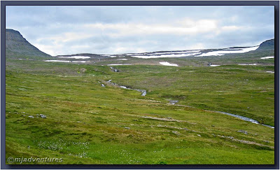
After packing up our supplies for the trip and psyching up the kids, we set off. Climbing up the first ascent is made easier by a track which was started by the Norwegian whalers before 1915 and winds its way up the Hesteyri valley. The builders really took the time to do it right as small, low bricked bridges over some of the streams still stand. The track was never completed because the station closed down.
As we climbed, we kept stopping to look at the scenery - it was superb. Everywhere we looked was another postcard image. It almost hurts to look at beautiful scenery like we were experiencing.
The boys were excited to refill their drink bottles from the pure mountain streams. The water tasted so good and at 3°C was refreshingly cold. The streams up the mountain kept our water in good supply - and the kids were kept busy looking for the next water stop!
We saw so many different flowers and plants that I'll have to do a separate post about them. It took me about 15mins to crawl up one steep 30m slope because I had to keep stopping to take photos of the flora! We also saw some beautiful vistas with streams and flowers.
Finally getting to the top of the valley from Hesteyri, we had to leave the track to head up the mountain. It was heavy going because in every direction there was wet, marshy land caused by the snow melt. Making it to the base of the first rock climb, we paused for lunch and gazed out at the scenery. We were looking at the other side of the Hornstrandir, northwest into the Aðalvik fjörd.
The flat topped peak is called Mt. Skorar or Mt. Straumnesfjall depending on who you talk to. Between 1954-56, NATO built a radar station at the top of the mountain and it was in service for 10 years. Hrólfur's brother-in-law Roland and some friends climbed up to the station while we were in Hesteyri, and they reported that it was very spooky. Even the concrete was different to anything that they had seen being used in Iceland! There is a steep road up the side of the mountain and the station was serviced by an airstrip built on a sand spit in Aðalvik Cove.
Before we continued, the boys took time to play on a nearby snowfield.
We continued on, climbing up beside a stream falling down a 30m cliff. It was hands, knees and feet time. Getting to the top and we were faced with another challenge of which way to go. The grassy way on the left looked tempting and J and the kids headed that way. One advantage of being a photographer is that I linger at places a lot longer than most. When the trio got caught in the middle of a swamp, I went to the right across the rocks. It took them about 10 minutes longer to get back to where I was!
We paused by a lake created by the snow melting. Now we knew where all the water in the valley was coming from!
The climb began to get harder now, and the last 200m was done on rocks as in the below image. In reality, we must have done a further 500m to get to the summit as we had to travel along some of the ridges as well as ascend.
It was no fun. The rocks were loose and we had to balance on top of them before progressing with the next step. It was all too easy to move the rocks and slip off them. This part of the climb took the longest, but finally, we could see the rock cairn which indicated the top of the mountain. Yay - we had made it!
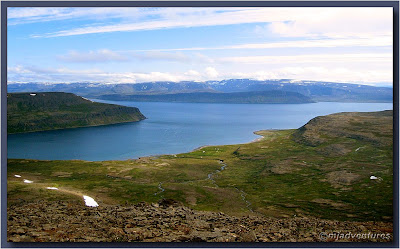
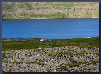
The view was heavenly. Elated, we stood and stared at the wonderful sight. The weather chose to clear up at just the right time, and we saw everything at its best. We looked down on Hesteyri and out over the Hesteyrarfjörður and Jökulfirðir (fjörds).
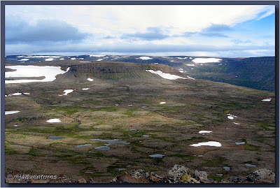
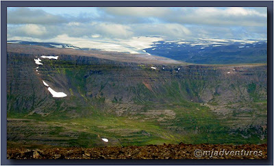
Looking back over our shoulders, we could see the next mountain range and the patches of snow further up which fed the main stream into Hesteyri.
The weather gods were smiling at us and even allowed us to glimpse the glacier Drangajökull, peeking out of the clouds in the next fjörd.
So much for 4 hours here and back - it had taken us about 4 hours to get to the top. Icelanders must travel faster with no stops and no photographs! Coming back down the rocky part was almost as bad as coming up, but this time we could see an easier way to go. It was longer but flatter. With relief we reached the 30m cliff again and crawled down it onto flatter land. We still had swamps to negotiate, but they were better than the loose rock.
Upon reaching the top of the Hesteyri Valley, we were again on the Whalers' Track, and everything became easier - except that my knees were killing me. It appears that I have inherited my father's knees. He has always told me that going up was fine in comparison to the pain going downwards. Now I knew what he meant!
By now it was about 5pm and the light in the valley got very vivid. Brilliant blues and greens could be seen everywhere and it was like looking through polarised sunglasses.
An hour later, and we were on the home stretch with the Doctor's House not too far away.
The below map shows the 2 outlooks that we viewed while on the hike. Blue is the direction we looked out to Aðalvik fjörd and Red is where we looked out to the Hesteyrarfjörður and Jökulfirðir (fjörds) and Drangajökull (glacier).

Next Chapter: Going Fishing








0 comments:
Post a Comment